
The app this map came from
Weather Navigation carries the same radar and road-surface data on Apple CarPlay and Android Auto, with a weather-aware route planner, storm-cell tracking and radar that refreshes every two minutes over the US.




Scan to install Weather Navigation
Radar, DOT cameras and live pavement conditions on the 299 miles of I-25 in Colorado — plus closures, road work and city-by-city weather across the state.
Updated Oct 8, 2026 9:12 PM MDT · Mostly dry
Lowest 57°F near Colorado Springs, Colorado · Highest wind 12 mph near Colorado Springs, Colorado
Use Weather Navigation for your next Road Trip
I-25 runs 299 miles across Colorado. It passes Colorado Springs, Denver and Fort Collins.
Weather data from Oct 8, 2026 9:12 PM MDT
Dry
I-25 crosses 299 miles of Colorado, between the Wyoming line and the New Mexico line. That is 28% of I-25's 1,063 miles.
Inside Colorado it meets I-70 and I-76 West at Denver.
By mile marker, I-25 passes Colorado Springs 142 · Denver 210 · Fort Collins 270.
2 current reports along the route. Always check with the responsible state DOT before setting off.
Between I-25 and I-25 (near Lynn) from Mile Point 288 to Mile Point 298. The right lane is closed due to road maintenance operations.
| Place | Snow a year | Snow days | Freezing nights | Freeze–thaw days | First freeze | Last freeze | Days over 90°F |
|---|---|---|---|---|---|---|---|
| Colorado Springs | 37.7" | 29.2 | 157.1 | 134.7 | Oct 4 | May 5 | 14.5 |
| Denver | 53.8" | 33.3 | 156.5 | 135.5 | Oct 6 | May 3 | 30.6 |
NOAA 1991–2020 Climate Normals, from 2 weather stations in Colorado. A dash is a figure that station does not report, not a zero.
From Trinidad to Wellington, with the position of each town measured along this stretch itself — counted from the Trinidad end, not from a state milepost, so it will not match the numbers on the signs.
Places from the US Census Gazetteer and population estimates, both public domain; distances measured along this page's own route geometry.
Colorado is one of the few states where winter tire rules are law, not advice. CDOT sets a Traction Law on the I-70 Mountain Corridor for the whole winter season and can activate one anywhere else in the state when a storm moves in, and drivers who ignore it are fined — more if they end up blocking a lane.
A Traction Law is in force on the I-70 Mountain Corridor between Dotsero and Morrison every year from September 1 through May 31, regardless of the forecast on the day. CDOT can also activate it on any other state highway when weather or road conditions require.
You need one of the following: an all-wheel or four-wheel drive vehicle on mud and snow (M+S), winter, or manufacturer-rated all-weather tires with at least 3/16-inch of tread — or, on any vehicle, chains or an approved alternative traction device on two or more drive tires.
In a severe storm CDOT escalates to the Passenger Vehicle Chain Law. Every vehicle then needs chains or an approved device, whatever it drives on — CDOT calls this the final safety measure before the highway closes, so a sign showing it means the road is close to shutting.
Non-compliance is a $100 fine plus a $33 surcharge. If your vehicle ends up closing a travel lane, that becomes $500 plus a $157 surcharge.
AutoSock, EasySox, Alpha Trax and ISSE tire socks are on the approved list. CDOT keeps the current list at apl.codot.gov.
Commercial vehicles have a separate rule. Under the Must Carry Law, anything over 16,000 pounds combined or carrying 16 or more passengers must carry chains from September 1 through May 31 on sections of I-70, Colorado 9 and US 40, 50, 160, 285 and 550 — $500 for not carrying them, and up to $1,000 plus a surcharge for blocking the road. CDOT keeps 130 chain stations across the state for it.
Text and email alerts are available from subscription.cotrip.org ↗.
Traction and chain law status is set by CDOT and changes with the storm. This page does not carry it — what it does carry, below, is CDOT's own report of the pavement on the I-70 corridor, which is a different thing. Check COtrip ↗ for the requirement in force before you drive.
Source: CDOT, checked August 26, 2026.
Summaries fetched Oct 8, 2026 6:01 AM MDT
Photo from
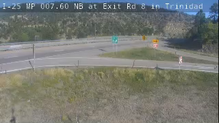
Photo from
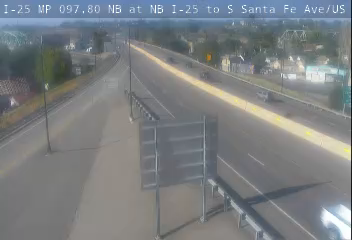
Photo from — last answered 49 minutes ago, so this is the last frame we have

Photo from — last answered 49 minutes ago, so this is the last frame we have

Photo from — last answered 49 minutes ago, so this is the last frame we have

Photo from
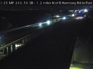
The same live radar and road-surface data as this map, on your phone and on Apple CarPlay or Android Auto.

Weather Navigation carries the same radar and road-surface data on Apple CarPlay and Android Auto, with a weather-aware route planner, storm-cell tracking and radar that refreshes every two minutes over the US.