
The app this map came from
Weather Navigation carries the same radar and road-surface data on Apple CarPlay and Android Auto, with a weather-aware route planner, storm-cell tracking and radar that refreshes every two minutes over the US.




Scan to install Weather Navigation
Radar, DOT cameras and live pavement conditions at the summit of Wolf Creek Pass and on both climbs — plus closures, road work and who sets chain control on US 160.
Elevation 10,857 ft · Updated Oct 8, 2026 7:34 PM MDT · Mostly dry
Lowest 52°F · Highest wind 7 mph
At the summit: Dry · 55°F · road surface est. 51°F · 7 mph wind · gusting 15 mph
Use Weather Navigation for your next Road Trip
Wolf Creek Pass carries US 160 over the Continental Divide at 10,857 feet, between South Fork and Pagosa Springs. It takes the heaviest snowfall of any highway pass in Colorado, and the long grades on both sides are where winter closures on the southern route across the state begin.
Weather data from Oct 8, 2026 7:34 PM MDT
Route geometry © openrouteservice.org · Map data © OpenStreetMap contributors
No full closures are reported on Wolf Creek Pass as of Oct 8, 2026 7:34 PM MDT, and no lane closures or roadworks either. Always check with the responsible state DOT before setting off.
Chain and traction requirements on Wolf Creek Pass are set by the state highway authority, and they are imposed and lifted through the day as a storm moves through. This page does not carry them — check COtrip ↗ before you set off. What the levels mean, with the exemptions and what you have to be carrying, is on the Colorado page.
What this page can tell you is the surface at the summit, from radar and surface analysis: currently dry, with the road surface estimated at 51°F. The road surface figure is an estimate derived from air temperature, not a measurement — bridges and overpasses run colder than the number shown.
At the summit, 10,857 ft. Each day shows its warmest and coldest hour, and the worst driving conditions forecast anywhere in it — not the average, because the hour that closes a pass is the one worth knowing about.
Rest of today Oct 8

40°F 39°F
Dry
Wind to 3 mph
Fri Oct 9

60°F 37°F
Wet worst around 8 PM
Wind to 7 mph
0.09 in
precipitation
Sat Oct 10
55°F 36°F
Dry
Wind to 10 mph
0.01 in
precipitation
Sun Oct 11
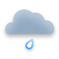
50°F 35°F
Wet worst around 10 AM
Wind to 13 mph
0.61 in
precipitation
Mon Oct 12

53°F 38°F
Ice worst around 12 AM
Wind to 12 mph
0.22 in
precipitation
Tue Oct 13
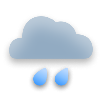
48°F 34°F
Ice worst around 4 AM
Wind to 10 mph
0.47 in
precipitation
Forecast, not a measurement — from the same weather service that draws this page's radar and road colors, model run 9 hours ago. Days run on Mountain time, the clock the pass keeps — not the reader's.
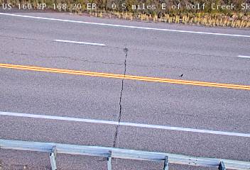
Photo from — last answered 6 hours ago, so this is the last frame we have
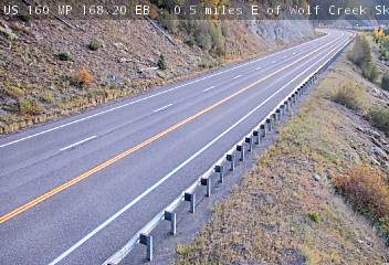
Photo from — last answered 6 hours ago, so this is the last frame we have
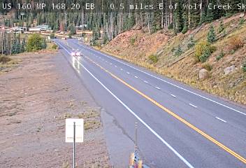
Photo from — last answered 6 hours ago, so this is the last frame we have
The same live radar and road-surface data as this map, on your phone and on Apple CarPlay or Android Auto.

Weather Navigation carries the same radar and road-surface data on Apple CarPlay and Android Auto, with a weather-aware route planner, storm-cell tracking and radar that refreshes every two minutes over the US.