California Road Conditions

California

California 511 Road Conditions & Chain Controls

Radar, DOT cameras and live pavement conditions on I-5, I-10, I-15, I-40 and I-80 — plus closures, road work and city-by-city weather across California.

Updated Sep 14, 2026 7:22 PM PDT · Mostly dry

Lowest 65°F near Los Angeles, California · Highest wind 21 mph near Barstow, California

Use Weather Navigation for your next Road Trip

California is a Pacific Coast state in the United States, known for Los Angeles, San Francisco and San Diego, and for interstates that climb out of the deserts and over the mountains between them: I-5 the length of the state over the Grapevine, I-80 across Donner Summit, I-15 through Cajon Pass, and I-10 and I-40 across the Mojave.

  • State type: U.S. state on the Pacific Coast
  • Year of statehood: 1850
  • Area: 163,696 sq mi

Temperature

Wind Speed

Rain Precip.

Coverage

Weather data from Sep 14, 2026 7:22 PM PDT

Up to 144 hours

Lowest temp.

65°F

Highest temp.

106°F

Highest wind

21 mph

Pressure

29.54-29.84 inHg

Conditions across California

California

Dry

  • San Diego 71°F · 7 mph wind · Dry
  • Sacramento 86°F · 2 mph wind · Dry
  • Barstow 93°F · 11 mph wind · Dry

Official California road conditions (QuickMap) ↗

QuickMap, California's official traffic and chain-control map

QuickMap is the traveler information map run by Caltrans, at quickmap.dot.ca.gov. It is the state's answer to what the road is doing at this minute, and Caltrans publishes on it:

  • Active chain control requirements statewide, refreshed every minute
  • Still camera images — chosen over video so the map keeps answering under load
  • Active lane closures, refreshed every five minutes; planned ones are left off
  • Full closures
  • CHP incident reports
  • Changeable message signs, but only the ones currently displaying something
  • Traffic speeds, and border wait times at the Mexican crossings

QuickMap and the conditions on this page

The chain-control layer is the one worth pairing with this page, because the two answer questions that only look alike. Caltrans states the restriction that is in force on Donner, the Grapevine or Mount Rose right now — a legal requirement it imposes and lifts through the day, which nothing here derives or guesses at. What this page adds is the surface underneath it: whether the pavement is wet, slushy, snow-covered or iced, and how cold it is at the summit as against the two climbs. A dry road under an R2 is a different drive from a glazed one, and QuickMap reports the same R2 for both.

California Closures & Road Blocks Today

3 current reports along the route, including 3 full closures. The 2 most serious are listed below. Always check with the responsible state DOT before setting off.

  • Road closed

    SR-20 closed

    Conventional Hwy closure. Work: Falsework Installation. Lanes closed: All. Near Nevada City, Nevada County.

    Nevada City • East • CA • Until Sep 20, 1:01 PM

  • Road closed

    I-5 closed

    Mainline closure. Work: Accident Investigation. Lanes closed: All. Near Pacoima, Los Angeles County.

    Pacoima • South • CA • Ongoing

Interstates Through California, Road by Road

Each stretch has its own live conditions, closures and cameras for the California miles only — the weather 500 miles away on the same interstate says nothing about this drive.

California driving weather by the numbers

Place Snow a year Snow days Freezing nights Freeze–thaw days First freeze Last freeze Days over 90°F
Los Angeles 0" 0 0 0 2.5
Sacramento 0" 0 5.1 5.1 Dec 18 Jan 19 74.4
San Francisco 0" 0 0.3 0.3 Dec 31 Jan 1 3.3
San Diego 0" 0 0 0 1.2

NOAA 1991–2020 Climate Normals, from 4 weather stations in California. A dash is a figure that station does not report, not a zero.

Every figure above is a town or a city. The summits are a different climate: Cajon Pass, Donner Pass (Donner Summit, I-80), The Grapevine (Tejon Pass, I-5) have its own page with the readings at the top and a six-day summit forecast.

Driving in California Month by Month

What the road normally throws at you, month by month, from NOAA's 1991–2020 normals for California's own stations. Each month names its dominant hazard and the place that measured it — this is what the month is usually like, not a forecast and not a restriction.

  • January Quiet 8.5 wet days at San Francisco is the most the normals report
  • February Quiet 7.7 wet days at San Francisco is the most the normals report
  • March Quiet 7 wet days at San Francisco is the most the normals report
  • April Quiet 3.7 wet days at San Francisco is the most the normals report
  • May Quiet 2.1 wet days at San Francisco is the most the normals report
  • June Heat 11.8 days above 90°F at Sacramento
  • July Heat 21.1 days above 90°F at Sacramento
  • August Heat 19.2 days above 90°F at Sacramento
  • September Heat 12.9 days above 90°F at Sacramento
  • October Quiet 2.2 wet days at Sacramento is the most the normals report
  • November Quiet 5.4 wet days at San Francisco is the most the normals report
  • December Quiet 8 wet days at San Francisco is the most the normals report

California Chain Controls: R-1, R-2 and R-3

California does not post a sentence, it posts a number. R-1, R-2 and R-3 are the three chain control levels Caltrans signs at the edge of the controlled stretch, and which one is up decides whether snow tires are enough — or whether anything is.

What R-1, R-2 and R-3 require

A snow-tread tire here carries MS, M/S, M+S or the words MUD AND SNOW on the sidewall and has at least 6/32-inch of tread — the same depth as Colorado's 3/16-inch, written the other way round. Chains means any approved traction device: link chains, cable chains, textile snow chains, hub-mounted and automatic chains all count, and Caltrans and the CHP can turn away a vehicle whose device does not meet the Vehicle Code.

R-1
Chains on everything except a car or light truck under 6,000 lbs with snow tires on at least two drive wheels — and that car still has to be carrying chains.
R-2
Chains on everything except four-wheel drive under 6,500 lbs with snow tires on all four wheels, again only if a set of chains is in the vehicle. This is where two-wheel drive stops being enough however good the tires are.
R-3
Chains on all vehicles, no exceptions, four-wheel drive included. Caltrans notes a highway is often closed before it goes this far, so R-3 usually means the road is about to shut.

Enforcement

Non-compliance is a citation from the California Highway Patrol, which is who enforces chain control rather than Caltrans; no fixed amount is published.

How you will know it is active

  • Signs at the start of the controlled stretch, showing R-1, R-2 or R-3
  • QuickMap, which carries statewide chain controls and refreshes them every minute
  • The Caltrans Highway Information Network on 800-427-7623

Which requirement is posted changes with the storm and with the elevation. This page does not carry it — QuickMap ↗ is the authority before you set off.

Source: Caltrans, checked August 26, 2026.

California weather along the interstates

Summaries fetched Sep 14, 2026 5:01 AM PDT

Sacramento, CA weather

  • Current weather conditions in Sacramento, CA indicate a temperature of 52°F with a relative humidity of 56%
  • The wind is blowing from the northwest at 2 mph
  • Visibility is good at 10 miles, and the weather is currently hazy
  • The atmospheric pressure is at 29.97 inHg
  • There are no active weather alerts at this time, and no precipitation is occurring.

Barstow, CA weather

  • Currently in Barstow, CA, the weather is clear with a temperature of 65.5°F and a dew point of 39.0°F
  • The humidity level is at 38%, providing a comfortable atmosphere
  • Winds are coming from the west at 8.4 mph, with a visibility of approximately 9.9 miles
  • The atmospheric pressure is measured at 29.8 inHg
  • No precipitation is occurring at this time, and there are no active weather alerts in the area.

Los Angeles, CA weather

  • Current weather conditions in Los Angeles, CA indicate a temperature of 67°F with a relative humidity of 79%
  • The dew point is at 60.4°F
  • Winds are light, coming from 110° (east-southeast) at 1.7 mph
  • Visibility is good at 9.9 miles
  • The weather is currently hazy, and there are no significant weather alerts in effect
  • The atmospheric pressure is measured at 29.83 inHg.

San Francisco, CA weather

  • The current weather in San Francisco, CA, is mostly clear with a temperature of 56°F
  • The humidity level is at 88%, indicating a damp atmosphere
  • Winds are calm, blowing from the southwest at 2 to 5 mph
  • The atmospheric pressure is 29.9 inHg, which is typical for this time of year
  • Visibility is good at 9.9 miles
  • Overall, conditions are stable with no significant weather alerts in effect.

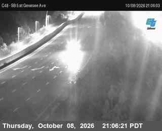
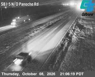
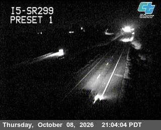
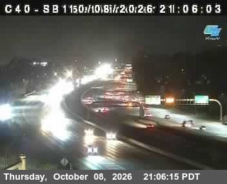
California Traffic Cameras

(C 009) I-5 : Just North Of Old Town, San Diego

Photo from — last answered 2 hours ago, so this is the last frame we have

Photo from camera: (C 009) I-5 : Just North Of Old Town, San Diego

(C 044) I-15 : Sabre Springs DAR, San Diego

Photo from — last answered 2 hours ago, so this is the last frame we have

Photo from camera: (C 044) I-15 : Sabre Springs DAR, San Diego

(C020) SB 5 : SR-94, San Diego

Photo from — last answered 2 hours ago, so this is the last frame we have

Photo from camera: (C020) SB 5 : SR-94, San Diego

(C030) SB 5: Just South Of I-15, San Diego

Photo from — last answered 2 hours ago, so this is the last frame we have

Photo from camera: (C030) SB 5: Just South Of I-15, San Diego

(C270) I-5 : NB Just North of La Costa Ave Top, Carlsbad

Photo from — last answered 2 hours ago, so this is the last frame we have

Photo from camera: (C270) I-5 : NB Just North of La Costa Ave Top, Carlsbad

28 - NB I-5 South Of SR120, Lathrop

Photo from — last answered 2 hours ago, so this is the last frame we have

Photo from camera: 28 - NB I-5 South Of SR120, Lathrop

California Road Weather FAQ

Are any roads closed in California right now?
Yes — 3 full closures are reported on the interstates in California as of Sep 14, 2026 8:32 PM PDT.
What are California road conditions today?
The map on this page colors the interstates across California by what is on the pavement right now — dry, wet, slush, snow or ice — from radar and surface data, last updated Sep 14, 2026 7:22 PM PDT. Right now temperatures run from 65°F to 106°F and the strongest wind is 21 mph.
What do R-1, R-2 and R-3 mean in California?
A snow-tread tire here carries MS, M/S, M+S or the words MUD AND SNOW on the sidewall and has at least 6/32-inch of tread — the same depth as Colorado's 3/16-inch, written the other way round. Chains means any approved traction device: link chains, cable chains, textile snow chains, hub-mounted and automatic chains all count, and Caltrans and the CHP can turn away a vehicle whose device does not meet the Vehicle Code.
What happens if you ignore a California chain control?
Non-compliance is a citation from the California Highway Patrol, which is who enforces chain control rather than Caltrans; no fixed amount is published.
Do I need chains to drive I-80 over Donner Pass in winter?
Not always. It depends which of 3 requirements is posted: "R-1" — chains on everything except a car or light truck under 6,000 lbs with snow tires on at least two drive wheels — and that car still has to be carrying chains. "R-2" — chains on everything except four-wheel drive under 6,500 lbs with snow tires on all four wheels, again only if a set of chains is in the vehicle. This is where two-wheel drive stops being enough however good the tires are. "R-3" — chains on all vehicles, no exceptions, four-wheel drive included. Caltrans notes a highway is often closed before it goes this far, so R-3 usually means the road is about to shut.
Which interstates run through California?
California has 5 through interstates on this site: I-5, I-10, I-15, I-40 and I-80 — about 1,673 miles of interstate across the state. Each has its own page for the California stretch.
Are there mountain passes in California?
Yes — 3 on this site: Donner Pass at 7,239 ft, The Grapevine at 4,144 ft and Cajon Pass at 3,777 ft. Each has its own summit page.
Are there live traffic cameras in California?
Yes. This page shows 6 live views in California from the state transportation departments' own camera feeds, further down the page, refreshed each time you load it.
How often are California road conditions updated?
The road surface and weather layers are rebuilt whenever this page is opened with data more than ten minutes old, and refreshed on a schedule in between, so nothing here is more than about two hours old even on a road nobody has looked at. Closures and road blocks are re-imported from the state 511 feeds every fifteen minutes, and the written state-by-state summaries are refreshed daily. Every section on this page carries the time its data was fetched.

Weather Road Planner for car and mobile

The same live radar and road-surface data as this map, on your phone and on Apple CarPlay or Android Auto.

Road Planner on Phone

The app this map came from

Weather Navigation carries the same radar and road-surface data on Apple CarPlay and Android Auto, with a weather-aware route planner, storm-cell tracking and radar that refreshes every two minutes over the US.


See everything the app does